.png)


.png)
Owner listed
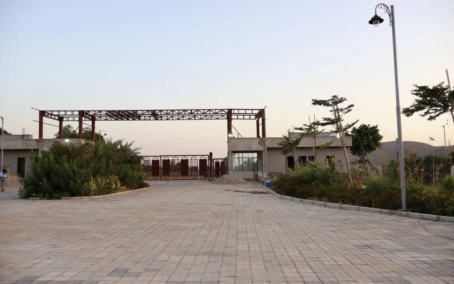
Ananda Agri Farm Tijara Alwar
Alwar, Rajasthan
Price on request15.00 acresView
District guide
Rajasthan's closest district to Gurugram — on the Delhi-Mumbai Expressway, priced well below the Haryana side of the same corridor.
Naugaon, Behror, Neemrana, Tijara
Sub-areas
~110 km
Gurugram Distance
Delhi-Mumbai Expressway
Primary Corridor
Open (Rajasthan-wide)
Legal Status
Land law is state law. These rules are maintained on the Rajasthan page and apply to every district within it.
✓ Rajasthan is the most open state in the Farmland India corridor for outside buyers. Since a 2010 amendment removed the non-agriculturist bar, any Indian citizen may buy agricultural land here — a rule most other North Indian states do not offer.
Who can buy agricultural land? Any Indian citizen — resident or non-resident of Rajasthan, agriculturist or not. This follows a 2010 amendment to the Rajasthan Imposition of Ceiling on Agricultural Holdings Act, 1973, which removed the earlier requirement that a buyer be a bona fide agriculturist. No domicile or residency test applies.
Ceiling limits still apply: a family may retain up to 18 acres of land with assured irrigation growing two crops a year, rising to 30 acres for single-crop irrigated land and up to 70 acres for unirrigated land, under Section 4 of the 1973 Act. Holdings above the applicable ceiling must be surrendered as surplus to the state.
SC/ST khatedar land — Section 42 of the Tenancy Act: land recorded to a Khatedar tenant belonging to a Scheduled Caste or Scheduled Tribe cannot be sold, gifted or bequeathed to a person outside that community. The Supreme Court (State of Rajasthan v. Aanjaney Organic Herbal Pvt. Ltd., 2012) confirmed this bar applies even to companies, and courts have repeatedly held that a purchase in breach of Section 42 is void from the start — possession, however long, does not cure it. Confirm the khatedar's community classification in the jamabandi before proceeding with any parcel.
Conversion for non-agricultural use — Section 90A: land bought for residential, commercial or farmhouse construction must be formally converted under Section 90A of the Rajasthan Land Revenue Act, 1956, which requires District Collector permission. Conversion must typically be applied for within a defined window of acquisition, with construction to commence within a set period after conversion is granted. Ask for the parcel's 90A/conversion status directly before assuming it is build-ready.
NRI & OCI buyers: FEMA 1999 prohibits NRIs and OCIs from acquiring agricultural land, plantation property or farmhouse land anywhere in India, Rajasthan included. NRIs may purchase a Section 90A-converted residential plot, subject to the same conversion rules above.
State land record — Alwar
Rev. 2026 · Farmland India desk
Divisions
Kumaon · Garhwal
Total districts
13
State area
~53,566 sq km
Agricultural land
~14% of state area
Forest cover
~64%
Land records portal
Bhulekh UK (digitised)
Governing acts
Bhu Kanoon 2025 · UPZALR 1950
Stamp duty (M/F)
5% / 3.75% + reg 2%
State overview
Uttarakhand sits along India's central Himalayan belt, carved from Uttar Pradesh in 2000 as India's 27th state. Two administrative divisions — Garhwal (seven districts, western half) and Kumaon (six districts, eastern half) — span from the Gangetic Terai plains in the south to the Greater Himalayan snow line in the north.
Only ~14% of the state is agricultural and 64% is under forest cover, making arable land structurally scarce. The population of ~10 million (Census 2011) is concentrated in the southern plains; the hill districts are among India's most sparsely populated.
For land buyers, the state splits into three geographies: the Terai plains (Haridwar, Udham Singh Nagar) with flat, irrigated farmland, where a discretionary (not automatic) agricultural-approval path exists for non-domiciled buyers; the Doon Valley and Shivalik foothills (Dehradun, Nainital, Kotdwar belt) with peri-urban and lifestyle land, domicile-only for agricultural purchase; and the mid-hills (Almora, Mukteshwar, Pauri) with orchard and eco-retreat land, also domicile-only.
Market bands
Bands are compiled from registered-transaction references and broker quotes in each district. All figures are admin-curated market bands, not live-listing computed.
| District | Zone / belt | Market band* | Unit | Access | Land type |
|---|---|---|---|---|---|
| Haridwar | Roorkee–Laksar agri belt | ₹15–25L | Bigha | Discretionary | Agricultural |
| Udham Singh Nagar | Rudrapur–Pantnagar belt | ₹12–22L | Bigha | Discretionary | Agricultural |
| Nainital | Ramnagar (Corbett belt) | ₹15–40L | Nali | Residents | Resort / farmhouse |
| Dehradun | Doon Valley periphery | ₹25–80L | Nali | Residents | Lifestyle / farmhouse |
| Pauri Garhwal | Kotdwar–Lansdowne belt | ₹5–18L | Nali | Residents | Agricultural / orchard |
*Indicative bands; individual parcels vary with road access, water source, conversion status and ESZ proximity. Stamp duty, registration and conversion charges additional. Past movement is historical, not a projection.
Transaction costs
5%
Stamp duty — male buyer
of property value or circle rate, whichever is higher
3.75%
Stamp duty — female buyer
concession to encourage female ownership
2%
Registration fee
of property value
Source: Indian Stamp Act 1899 (Uttarakhand schedule), Registration Act 1908. Rates apply to conveyance/sale deed registration. Gift, partition and lease deeds carry different schedules. Confirm the current rate with the Sub-Registrar before budgeting.
Connectivity
Uttarakhand is a Delhi/NCR market for its plains and foothill districts. Journey times vary with season, monsoon road conditions and traffic — treat these as planning estimates.
The Delhi–Dehradun Expressway is the single biggest driver of land values in Haridwar and Dehradun once fully operational. See the route, construction status and land-impact analysis in our Delhi–Dehradun Expressway wiki guide.
Growth catalysts
Status labels maintained by the Farmland India research desk. Government-announced timelines — not guaranteed.
The 210-km greenfield expressway will compress Delhi–Dehradun drive time from 5.5 hours to roughly 2.5. The single largest re-rating event for Haridwar and Dehradun land values.
Full corridor guide & alignment →Widened highways to Yamunotri, Gangotri, Kedarnath and Badrinath, keeping hill routes open through the monsoon — directly benefits homestay and retreat land along the corridor.
A broad-gauge line taking rail into the Garhwal hills beyond Rishikesh — stations along the route are the places to watch once timelines firm up.
Expansion at both state industrial estates is lifting warehousing and land demand in Haridwar and Udham Singh Nagar — the two districts where a discretionary agricultural-approval path exists for non-domiciled buyers.
Agriculture & terrain
The agricultural profile changes dramatically with altitude — soil, crops and income model differ almost entirely across the three belts.
Deep alluvial, canal- and tubewell-irrigated. Sugarcane, basmati rice, wheat, soybean. Flat terrain, mechanised farming viable. Data: Soil Health Card portal.
Sandy-loam Bhabar belt transitioning to forest-floor soils. Rice paddies, mango, guava, poultry. Springs and small rivers are the primary irrigation source.
Shallow, loamy-skeletal terraced soils, 1200–2200 m altitude. Apple, walnut, stone fruit, medicinal herbs. Spring-fed irrigation only.
Live wholesale mandi prices for basmati rice, wheat and apple across Uttarakhand's regulated markets are published daily on Agmarknet — check the Haridwar or Rudrapur mandi for the Terai belt, or the Ramnagar/Haldwani mandi for the hill-orchard economy.
Terai: canal and tubewell. Foothills: river-fed and borewell. Hills: spring-fed — many natural springs are showing reduced flow (IMD rainfall normals). Ask for the parcel's water source directly and, where possible, test it in the dry season before relying on it.
Hill districts measure in Nali (~200 sq m, ~2,153 sq ft); 20 Nali = 1 Bigha (local). Terai plains measure in Bigha (~6,773 sq ft, ~0.16 acre) — a different Bigha from Rajasthan or UP. Always confirm the unit stated on a listing.
At a glance
| District | Price band* | Delhi distance | Access |
|---|---|---|---|
| Nainital | ₹15–40L/nali | ~260–310 km | Residents only |
| Haridwar | ₹15–25L/bigha | ~210 km | Discretionary |
| Udham Singh Nagar | ₹12–22L/bigha | ~250 km | Discretionary |
*Same indicative-band caveat as the district price table above. Note the unit difference — Nainital prices are per Nali, the Terai districts per Bigha.
Farmland India view
Six structural reasons, in the order this desk underwrites them.
64% of the state is protected forest. Arable land cannot expand.
Compressing 5.5 hours to ~2.5 — Haridwar/Dehradun periphery land is still pricing in the old distance.
Haridwar and Udham Singh Nagar offer a real discretionary agricultural-approval route — flat, irrigated, productive land, though not a guaranteed purchase.
Jim Corbett, Rishikesh, Char Dham — tourism gives resort and eco-farmhouse land a rental-income thesis beyond appreciation alone.
Apple and walnut farming in Kumaon generates real annual income.
Comparable hill-station farmhouse land in Shimla or Kullu trades higher for similar altitude and access.
Even in Haridwar & Udham Singh Nagar, agricultural approval is discretionary, not automatic — confirm your own eligibility and prospects directly before shortlisting.
STRAIGHT TALK
Read these before shortlisting — the land market here carries risks sharper than most of the corridor.
Buying through a resident nominee or benami arrangement is illegal and actively prosecuted. Confirm your own eligibility before engaging with any listing — including in Haridwar/USN, where approval is discretionary, not guaranteed.
A parcel that looks like farmland may be classified as forest in revenue records, making it non-transferable. Cross-check the land-use classification in the khatauni directly.
ESZ buffers around national parks restrict construction within defined distances. Ask for the parcel's distance from the reserve boundary before assuming it is buildable.
Much of the hill region is seismic Zone IV/V with active landslide and flash-flood risk. Assess terrain stability and drainage before buying.
Natural springs are drying up across Kumaon and Garhwal. A hill parcel without a confirmed year-round spring has limited value — test it yourself, ideally in dry season.
Multi-generational joint khatas with unclear mutation trails are common. Insist on a current khatauni from Bhulekh UK and a clean mutation chain.
Who to contact
Section 143 conversion applications and mutation route through the Sub-Divisional Magistrate (SDM) office of the relevant tehsil. Non-resident state-permission applications go to the state government directly, not the district. Sale-deed registration is handled by the local Sub-Registrar. Office locations are listed on the Uttarakhand Revenue Department portal.
DEVELOPER PROJECTS · TRUST SCORE
Developer projects carry the platform Trust Score and a reviewed document set.
Reviewed projects have completed Farmland India's document and site review. Individual land parcels are listed by their owners and are not reviewed to the same standard. Always complete your own legal due diligence.
INDIVIDUAL LAND · LAND VERIFICATION SCORE
Individual listings carry the auto-calculated Land Verification Score (LVS).
Reviewed projects have completed Farmland India's document and site review. Individual land parcels are listed by their owners and are not reviewed to the same standard. Always complete your own legal due diligence.
KEEP EXPLORING
Micro-markets in Alwar
Other districts in Rajasthan
Guides & research
COMMON QUESTIONS
Everything buyers, NRIs and investors ask before their first reviewed farmland purchase in Alwar.
Visit full wiki01 of 03
It sits directly on the Delhi-Mumbai Expressway, roughly 110 km / 2 hours from Gurugram, at a fraction of Gurugram-belt farmhouse pricing.
02 of 03
Only outside the eco-sensitive zone buffer, and construction is restricted within it. Confirm ESZ distance directly for any parcel near the reserve.
03 of 03
Yes, in part. Eastern Alwar territory now falls under the new Khairthal-Tijara district. Confirm which district registry your parcel sits in.
Ready to look at what is available?
Browse reviewed listingsTransparency
Data-currency note: Census figures reflect 2011, the most recent full Census — not current-year population. Report inaccuracies to wiki@farmlandindia.com.
For developers
Browse reviewed projects and individual land parcels across Alwar — or if you own land here, list it with platform review and reach serious buyers.
Farmland India ("the Platform"), operated by Bulk Procure Private Limited, is a digital marketplace for listing agricultural land, farmhouse and plotted development projects. The Platform is not a real estate broker, agent or intermediary under RERA or any other applicable law, and does not act for either party to a transaction.
Listings are submitted by developers, owners and their authorised representatives. Before publication, the Platform carries out a documentary review of the material supplied and records what was sighted. That review is limited to the documents made available to us at that time. It is not a title investigation, not a legal opinion, and not a warranty of title, approvals, or the accuracy of any information supplied by a lister. The Trust Score is an internal assessment produced from that review and is intended as a research aid, not as a guarantee of outcome.
Every buyer must carry out independent due diligence before any transaction — including verification of land records, encumbrance searches, approvals and regulatory compliance — through their own advocate and chartered accountant. Any legal or advisory professional introduced through the Platform is engaged directly by the user, on that professional's own terms; the Platform does not employ, supervise or accept responsibility for their work.
Nothing on the Platform is investment advice. Land values can fall as well as rise. The Platform is not liable for any loss, dispute or damage arising from a transaction between parties.