

Owner listed
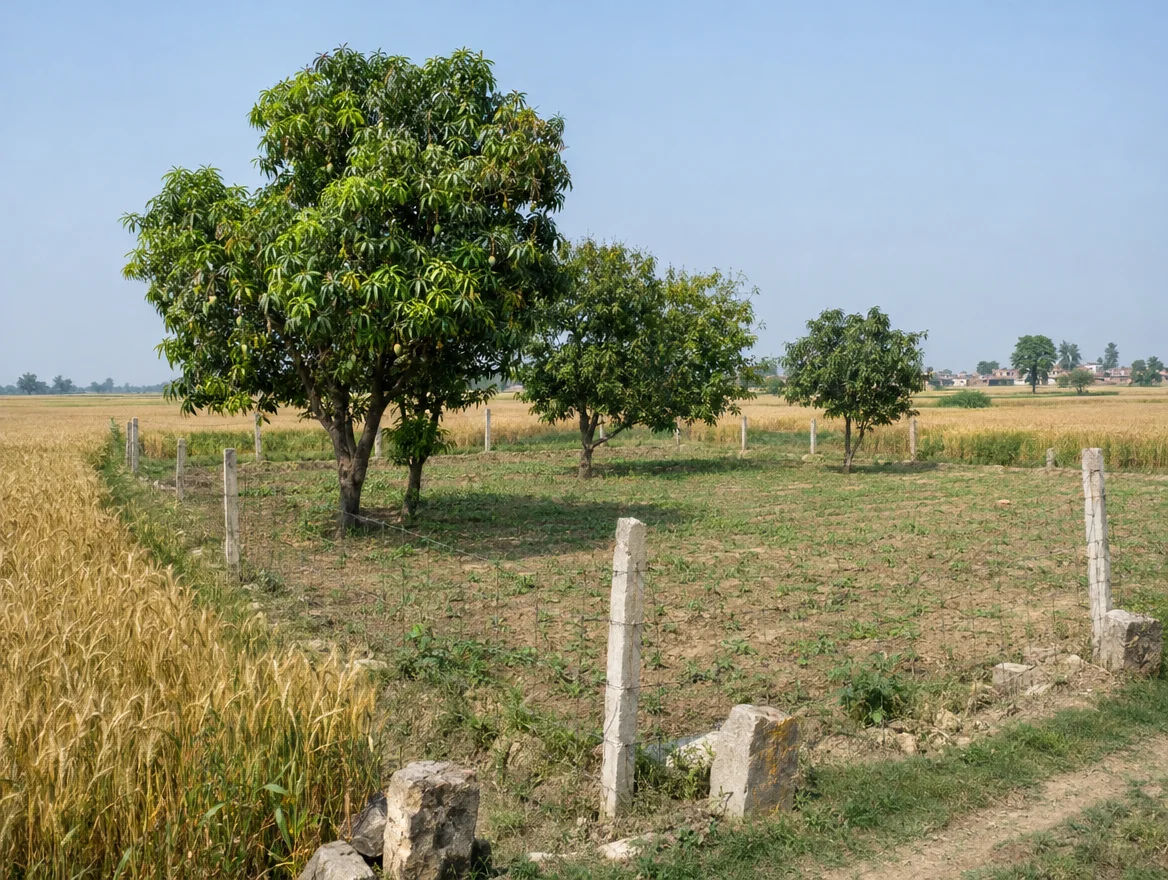
2.1 Acre Agricultural Land in Salarpur, Muzaffarnagar
Salarpur, Muzaffarnagar, Uttar Pradesh
10800000010206.00 Sq.Yd.View
District guide
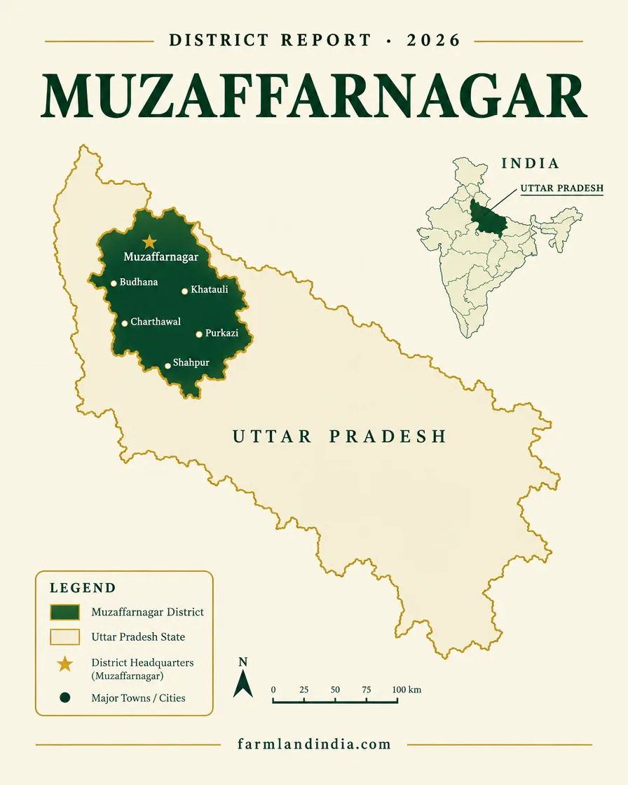
A cane and jaggery district on NH-58, with tubewell-irrigated alluvial farmland, water-stressed blocks, a notified expressway corridor across 45 villages and no sourced per-acre price series.
2,991 sq km
Area
4 tehsils, 9 blocks
Tehsils and blocks
~2.25 lakh ha
Sugarcane (ICAR, 2008-09)
45 villages notified
Shamli–Gorakhpur corridor
*Indicative range across districts and land types. Stamp duty, registration and conversion charges are additional. Local measurement units vary — every listing states the unit it is priced in. Not a valuation or an offer.
IGRS UP — Registration & Land Records PortalDistrict land record — Muzaffarnagar
Rev. 2026 · Farmland India desk
State
Uttar Pradesh
Villages
704 in the portal’s table, 1,019 in its text (139 uninhabited), unexplained (district portal, October 2026)
Key markets
Muzaffarnagar city · Khatauli · Budhana · Jansath · Purquazi
Demand anchors
Sugar mills and a gur (jaggery) cluster (industrial profile) · NH-58 through the city · Shamli–Gorakhpur Expressway corridor notified in January 2026 (Gazette of India, 20 January 2026)
Delhi
NH-58 passes through the city (industrial profile); no sourced distance, so check a live route
Tehsils and blocks
4 tehsils (Muzaffarnagar, Budhana, Jansath, Khatauli) and 9 blocks: Kukda, Budhana, Baghra, Shahpur, Purquazi, Charthawal, Morna, Jansath and Khatauli (district portal, October 2026; district portal, October 2026)
Land units
Ask for area in acres or hectares as shown on the khatauni; local units vary by district
Land records portal
UP Bhulekh · registration on IGRS UP
Land law is state law. These rules are maintained on the Uttar Pradesh page and apply to every district within it.
⚠ Two checks come before any advance in Uttar Pradesh: the Revenue Code limit of 5.0586 hectares (about 12.5 acres) on what one person can acquire by purchase or gift, and the registry position in the DNGIR villages near Noida, where a purchase halt was reported in January 2024 and no later word was found. UP Revenue Code 2006, section 89; Sakshi Post, January 2024.
Who can buy agricultural land? The Revenue Code sections we read set a size limit (section 89) and special rules for land held by Scheduled Caste and Scheduled Tribe members (sections 98 and 99). None asks the buyer to be a farmer or to live in the state (UP Revenue Code 2006, IGRS UP). We did not read the whole tenure chapter, so ask the Sub-Registrar whether anything further applies. The Code repealed the Zamindari Abolition and Land Reforms Act 1950 when it was enforced on 18 December 2015 (SCC Online, February 2016).
Holding limit: section 89(2) of the Code bars a purchase or gift that would take the buyer's total holding in Uttar Pradesh above 5.0586 hectares, about 12.5 acres on our conversion (UP Revenue Code 2006). Under the earlier Act the Supreme Court read a company as a person for this limit and let the excess vest in the State (Oswal Fats and Oils, April 2010). The separate 1960 Ceiling Act caps total holdings; the India Code text gives 7.30 hectares of irrigated land for a family of five or fewer, with additions for larger families, and the text mixes acres and hectares, so the current schedule needs checking (India Code).
DNGIR villages: the Dadri-Noida-Ghaziabad Investment Region covers 84 notified villages, 63 in Bulandshahr and 21 in Gautam Buddh Nagar, notified in October 2024 (Swarajya, July 2026). In January 2024 a Noida Authority letter to the Stamp Department halted purchase and sale in the proposed villages, with registration of agricultural land needing the Authority's consent (Sakshi Post, January 2024). Two July 2026 reports on acquisition by mutual consent do not mention the halt (Millennium Post, July 2026), so ask the Noida Authority or the District Magistrate's office whether it still applies to a given village.
Scheduled Caste and Scheduled Tribe land: a Scheduled Caste bhumidhar needs the Collector's previous written permission to transfer land to a non-Scheduled Caste buyer (section 98), and a Scheduled Tribe bhumidhar may not transfer to a non-Scheduled Tribe buyer (section 99) (UP Revenue Code 2006). The Allahabad High Court described a transfer without the permission as void in Omwati v District Collector, Pilibhit, November 2022.
NRI & OCI buyers: the Reserve Bank's Master Direction under FEMA 1999 excludes agricultural land, plantation land and a farm house from what NRIs and OCIs may buy or receive as a gift (paragraphs 3.1.1 and 3.1.2). Inheritance is covered separately in paragraphs 3.1.3 and 3.1.4, without that exclusion (Reserve Bank of India Master Direction FED 12/2015-16).
The Uttar Pradesh legal framework on the state page (the Revenue Code limit of 5.0586 hectares on purchases, Collector permission for land held by Scheduled Caste members, the bar on non-ST buyers for Scheduled Tribe land, and the NRI and OCI bar on agricultural land) applies to Muzaffarnagar in full. The notes below are specific to this district and are not repeated from the state page.
⚠ We found no source that places Muzaffarnagar in the National Capital Region, so NCR master-plan rules should not be assumed. Land along NH-58, around Muzaffarnagar city and near Khatauli is likelier to sit inside a notified development or master-plan area, but we found no list. Ask the Tehsil in writing whether the village is inside such an area before paying an advance.
⚠ To use farmland for a farmhouse, resort or other non-farm purpose, the owner needs a declaration from the revenue authority. Under Section 80 of the UP Revenue Code, 2006, the Sub-Divisional Officer decides within 45 working days (Revenue Code text). The 2019 amendment replaced Section 80: the new sub-section (2) allows a declaration for proposed non-agricultural use, which needs a boundary wall around the holding, lapses if the activity does not start within five years and does not change land use, so the land continues to be treated as agricultural (UP Revenue Code (Amendment) Act, 2019). Ordinance No. 14 of 2026 adds that an approved layout or building plan in a development authority area counts as a declaration (PRS Legislative Research). Older papers may cite Section 143 of the 1950 Zamindari Abolition Act, which the Code replaced on 18 December 2015 (SCC Online, February 2016); the Supreme Court in Mahesh Chand v. Brijesh Kumar, reported on 20 August 2025, called registration of a Section 143 declaration merely a procedure the landowner is not required to follow (Verdictum, August 2025). Ask for the declaration itself, not a promise of one.
⚠ In Kanhaiya Lal Trust v. State of U.P., reported on 25 April 2023, the Allahabad High Court held that a nursery is not a non-agricultural use, because Section 4(2) of the Revenue Code lists horticulture and flower farming within agriculture (Verdictum, April 2023). That matters for orchard and nursery buyers. Highway-side plots are sometimes marketed as farm land: ask for the recorded land use on the khatauni, and ask whether any plotted layout is registered with UP-RERA, before paying a booking amount.
District overview
Muzaffarnagar covers 2,991 sq km in four tehsils and nine development blocks (district portal, October 2026). Population and village figures conflict: the portal’s table lists 704 villages while its text says 1,019, and the industrial profile’s 4,138,605 people and 4,008 sq km cover the district before Shamli was carved out of it, so we show no population figure. The industrial profile lists large sugar mills, a seasonal gur (jaggery) cluster with a large wholesale market, and steel and paper units (industrial profile).
NH-58 passes through the city, and the district had 73 km of national highway and 85 km of rail line in 2010-11 (industrial profile). The 82 km Delhi–Meerut Namo Bharat corridor, dedicated on 22 February 2026, ends in Meerut, not Muzaffarnagar (AIR, February 2026), so a buyer from Delhi still combines a road leg with the rail. A second group buys here as a stop towards the Uttarakhand foothills, a market covered on our Uttarakhand page. We found no sourced Delhi distance, so check a live route.
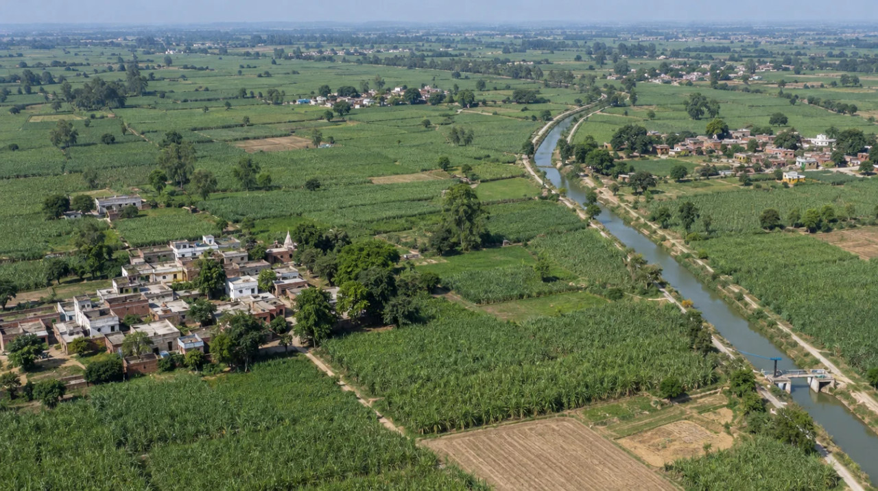
On the land side this is cane country: the ICAR-CRIDA plan (crop data 2008-09) records 224,740 ha of sugarcane against 130,610 ha of wheat and 35,635 ha of rice, on loam and sandy-loam alluvium, with tubewells irrigating about three-quarters of the net irrigated area (ICAR-CRIDA plan). Water is the main caution, because the UP Ground Water Department’s 2022 categorisation puts one unit (Baghra) in the over-exploited class and two (Budhana and Charthawal) in the critical class (NGT filing, 2022). We found no sourced price series for farmland.
Market & connectivity
Reported figures and project status, with the source and month of each. Where no official or dated figure exists, we say so.
We publish no per-acre band for Muzaffarnagar, because the only figures available were listing-site asking prices, which cannot be traced to registered deals. The Stamp Department’s collector rates were not opened for this page: ask the Sub-Registrar for the village rate and for recent registered sales in the same village.
Ministry of Road Transport and Highways notification S.O. 316(E) of 20 January 2026 covers Km 1.5 to Km 55 of the Panipat–Gorakhpur (Shamli–Kheri Phase-1) high-speed corridor in Muzaffarnagar tehsil, with 45 villages and the ADM (Finance and Revenue), Muzaffarnagar as competent authority (Gazette of India, 20 January 2026). We found no compensation rate for these villages.
Without a sourced series, any per-acre figure quoted to you is an asking price. Ask each seller for the village, the collector rate and the nearest registered sale, and compare larger interior parcels with compact roadside ones only on those terms.
We found no sourced per-sq-yd price for Khatauli, Budhana or other plots. Plot prices are not a guide to farm acreage, and a plot described as farm land on a highway bypass may or may not carry a non-agricultural declaration.
Sugarcane dominates the cropped area in the ICAR plan, and the industrial profile lists large sugar mills and a gur cluster. Cane income alone is unlikely to explain highway-edge prices, so the case for buying rests on location, access and permitted use rather than yield.
Collector rates for Muzaffarnagar villages were not opened for this page. The state page gives stamp duty of 7%% for a male buyer and 6%% for a sole female buyer, plus 1%% registration, as quoted but not confirmed from the Stamp Department; confirm the village rate and the current schedule before pricing an offer.
Connectivity
NH-58 passes through the city. We found no sourced distance to Delhi, so check a live route; the Uttarakhand foothills lie further north.
The Panipat–Gorakhpur (Shamli–Kheri Phase-1) corridor is notified across 45 Muzaffarnagar-tehsil villages (Gazette of India, 20 January 2026); construction has not started. The 210 km Delhi–Dehradun Expressway, reported open on 14 April 2026 (Swarajya, April 2026), is described as spanning Delhi, Uttar Pradesh and Uttarakhand; the reports we read name Baghpat and Saharanpur on the route and no spur to Muzaffarnagar (Indian Infrastructure, May 2026). For the rules that apply to a purchase, see our Uttar Pradesh land-rules guide.
Growth catalysts
Status labels maintained by the Farmland India research desk. Government-announced timelines — not guaranteed.
NH-58 passes through Muzaffarnagar city, and the district had 73 km of national highway and 85 km of rail line in 2010-11 (industrial profile). Four-laning of the Shamli–Muzaffarnagar section of NH-709AD was among the projects launched on 25 January 2024 (PMO); we found no completion report.
The full 82 km corridor was dedicated on 22 February 2026 and ends at Modipuram in Meerut (AIR, February 2026). It does not reach Muzaffarnagar, but it shortens the Delhi leg for anyone driving on from Meerut.
A 210 km expressway costing Rs 11,868.6 crore, reported open on 14 April 2026 (Swarajya, April 2026; Indian Infrastructure, May 2026). The reports name Baghpat and Saharanpur on the route and no spur to Muzaffarnagar.
NHAI was reported in May 2026 to have begun land acquisition for a roughly 742 km corridor costing about Rs 40,000 crore from the Haryana border near Shamli to Kushinagar, with full completion targeted for 2030 (NBM&CW, May 2026). Swarajya lists Muzaffarnagar as the second district after Shamli (Swarajya, May 2026), and the January 2026 notification covers Km 1.5 to 55 in Muzaffarnagar tehsil (Gazette of India, 20 January 2026). Confirm the alignment for a given village with the competent authority.
Agriculture & terrain
Muzaffarnagar is cane-and-wheat country on loam and sandy-loam alluvium, irrigated mostly by tubewells, with several water-stressed units.
The ICAR-CRIDA contingency plan (2012; crop data 2008-09) records 326,920 ha of net sown area at a cropping intensity of about 144%, on loam (36.6%), sandy-loam (32.5%), clay-loam (18.1%) and silty-loam (12%) soils. Sugarcane covers 224,740 ha, wheat 130,610 ha and rice 35,635 ha (ICAR-CRIDA plan). The plan does not say whether its areas include the part later formed as Shamli district, so use them for orders of magnitude.
Normal rainfall is 785.6 mm a year in the ICAR plan (639.5 mm in the monsoon) (ICAR-CRIDA plan). The UP Ground Water Department’s 2022 categorisation lists Baghra as over-exploited, Charthawal and Budhana as critical, and Shahpur and Muzaffarnagar as semi-critical (NGT filing, 2022); the older ICAR plan named only Shahpur as critical. CGWB’s December 2024 report lists no Muzaffarnagar water-quality exceedance (CGWB, December 2024). Check the unit for any parcel and test borewell yield.
In the ICAR plan, tubewells and borewells irrigate 76.7% of the net irrigated area, canals 21.8% and open wells 1.1% (ICAR-CRIDA plan). The industrial profile notes the Upper Ganga and Lower Yamuna canals in the district (industrial profile). A tubewell-dependent parcel carries a running electricity or diesel cost, so ask for the pump record and the canal watercourse, if any.
Wholesale prices for Muzaffarnagar-district markets are published daily by Agmarknet, which we did not open for this page. Wheat and rice are the benchmarks; cane is bought by sugar mills at the state-notified price, and jaggery trades through local markets. Farm income is small next to highway-edge prices, so price a parcel on location and permitted use, not on yield.
At a glance
| District / belt | Price evidence* | Evidence |
|---|---|---|
| Muzaffarnagar district, farmland | No per-acre price sourced | Collector rate not opened; ask the Sub-Registrar |
| Muzaffarnagar — Shamli–Gorakhpur corridor (45 villages) | No compensation rate found | Notified 20 January 2026 (Gazette of India) |
| Muzaffarnagar — NH-58 and Khatauli plots | No sourced per-sq-yd price | Approval status decides what can be built |
| Muzaffarnagar — groundwater units | 1 over-exploited, 2 critical, 2 semi-critical | UP Ground Water Department, 2022 |
| Meerut | No sourced price series | See the Uttar Pradesh state page |
| Shamli | No sourced price series | Shamli–Gorakhpur corridor starts near Shamli (Swarajya, May 2026) |
*No per-acre or per-sq-yd price series is sourced for any district shown. The table lists the evidence that exists, not prices, and it is not like-for-like.
Farmland India view
Three reasons this desk includes Muzaffarnagar, with an honest note that we have no sourced price series, water is uneven and the expressway corridor is still at acquisition stage.
Sugarcane covers 224,740 ha in the ICAR plan, and the industrial profile lists large sugar mills and a gur cluster. The district does not depend on speculation to function.
NH-58 and 85 km of rail line serve the district (industrial profile, 2010-11), and the Shamli–Gorakhpur corridor has been notified across 45 villages in Muzaffarnagar tehsil.
City-edge, highway-side and interior farmland are different markets. We found no sourced prices for any of them, so compare registered sales village by village.
Confirm master-plan status, the non-agricultural declaration and groundwater category directly — these are not certified by Farmland India's review.
STRAIGHT TALK
Read these before shortlisting in Muzaffarnagar specifically.
We found no official or news series for Muzaffarnagar farmland. Gather registered deeds and collector rates before negotiating.
The 2022 categorisation lists Baghra as over-exploited and Budhana and Charthawal as critical. Check the unit for the village and test borewell yield.
Crop areas come from 2008-09, the industrial profile from 2010-12 and the Census from 2011. Use current district agriculture-office data and treat these figures as context.
Plots on NH-58 may be marketed as agricultural. Ask for the land use on the khatauni and any non-agricultural declaration.
Population and area figures predate the 2011 split of Shamli (4,138,605 people and 4,008 sq km in the industrial profile), and the portal gives 704 or 1,019 villages. Use figures as orders of magnitude.
The Shamli–Gorakhpur corridor is notified for Km 1.5 to 55 in Muzaffarnagar tehsil, but completion is targeted for 2030 (NBM&CW, May 2026). Ask for the alignment and notification for the exact survey number.
Namo Bharat stops at Meerut, so the Delhi journey is still road or conventional rail. Do not price the parcel on a rapid-rail extension.
Who to contact
Mutation, khatauni extracts and record corrections for Muzaffarnagar, Budhana, Jansath and Khatauli are handled at the tehsil, with the District Magistrate’s office as the district authority; contacts are on the Muzaffarnagar district website. Sale-deed registration is at the local Sub-Registrar through IGRS UP, and land records are read on UP Bhulekh; we did not open either portal for this page. Questions about master-plan areas, layouts and building approvals go to the development authority that covers the village, if any; confirm the exact office with the District Magistrate’s office.
INDIVIDUAL LAND · LAND VERIFICATION SCORE
Individual listings carry the auto-calculated Land Verification Score (LVS).
Reviewed projects have completed Farmland India's document and site review. Individual land parcels are listed by their owners and are not reviewed to the same standard. Always complete your own legal due diligence.
KEEP EXPLORING
Other districts in Uttar Pradesh
Guides & research
COMMON QUESTIONS
Everything buyers, NRIs and investors ask before their first reviewed farmland purchase in Muzaffarnagar.
Visit full wiki01 of 04
We publish no per-acre band, because listing-site asking prices could not be traced to registered deals, and we found no official or news price series. Ask the Sub-Registrar for the village collector rate and for recent registered sales in the same village.
02 of 04
NH-58 passes through the city and the district has 85 km of rail line (industrial profile, 2010-11). The Namo Bharat corridor ends at Modipuram in Meerut (All India Radio, February 2026), and we found no extension to Muzaffarnagar. We found no sourced distance or journey time, so check a live route.
03 of 04
The UP Ground Water Department’s 2022 categorisation lists Baghra as over-exploited, Charthawal and Budhana as critical, and Shahpur and Muzaffarnagar as semi-critical. The older ICAR-CRIDA plan (2012) named only Shahpur as critical, so confirm the current category for your village.
04 of 04
A Ministry of Road Transport and Highways notification of 20 January 2026 covers Km 1.5 to 55 of the Panipat–Gorakhpur (Shamli–Kheri Phase-1) corridor in Muzaffarnagar tehsil, with 45 villages. NBM&CW (May 2026) reports acquisition under way and full completion targeted for 2030.
Ready to look at what is available?
Browse reviewed listingsTransparency
Law and courts
Government
News
Further reading
Data-currency note: census figures reflect 2011, and the district was reduced when Shamli was formed in September 2011, so older tables (industrial profile, ICAR-CRIDA plan) may include land now in Shamli. The ICAR-CRIDA crop data is from 2008-09, the industrial profile mostly from 2010-12 and the groundwater categories from the 2022 assessment; infrastructure items are as reported up to October 2026. We found no sourced price series, so no price is shown; collector rates and the IGRS UP, UP Bhulekh and UP-RERA portals were not opened for this page. This is a general guide, not legal advice. Report inaccuracies to wiki@farmlandindia.com.
For developers
Browse reviewed projects and individual land parcels across Muzaffarnagar — or if you own land here, list it with platform review and reach serious buyers.
Farmland India ("the Platform"), operated by Bulk Procure Private Limited, is a digital marketplace for listing agricultural land, farmhouse and plotted development projects. The Platform is not a real estate broker, agent or intermediary under RERA or any other applicable law, and does not act for either party to a transaction.
Listings are submitted by developers, owners and their authorised representatives. Before publication, the Platform carries out a documentary review of the material supplied and records what was sighted. That review is limited to the documents made available to us at that time. It is not a title investigation, not a legal opinion, and not a warranty of title, approvals, or the accuracy of any information supplied by a lister. The Trust Score is an internal assessment produced from that review and is intended as a research aid, not as a guarantee of outcome.
Every buyer must carry out independent due diligence before any transaction — including verification of land records, encumbrance searches, approvals and regulatory compliance — through their own advocate and chartered accountant. Any legal or advisory professional introduced through the Platform is engaged directly by the user, on that professional's own terms; the Platform does not employ, supervise or accept responsibility for their work.
Nothing on the Platform is investment advice. Land values can fall as well as rise. The Platform is not liable for any loss, dispute or damage arising from a transaction between parties.